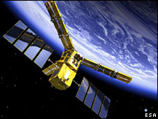
The second satellite in European Space Agency’s (ESA) Earth Explorer series – the Soil Moisture and Ocean Salinity (SMOS) mission were launched into orbit on 2 November 2009 from northern Russia.
SMOS will play a key role in the monitoring of climate change on a global scale. It is the first ever satellite designed both to map sea surface salinity and to monitor soil moisture on a global scale. It features a unique interferometric radiometer that will enable passive surveying of the water cycle between oceans, the atmosphere and land.
SMOS is a 658-kg satellite developed by ESA in cooperation with France’s CNES and Spain’s Centro para el Desarrollo Tecnologico Industrial (CDTI). It is based on the Proteus small satellite platform designed and built by Thales Alenia Space and its payload is composed of a single instrument, the Microwave Imaging Radiometer using Aperture Synthesis (MIRAS), developed by EADS CASA Espacio.

MIRAS is an interferometer that connects together 69 receivers mounted on three deployable arms to measure the temperature of the reflection of the Earth’s surface in the microwave frequency range. This temperature is linked to both the actual temperature of the surface and its conductive characteristics, which are in turn linked to soil moisture for land surface and to water salinity for sea surface
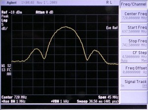
The data collected by SMOS will complement measurements already performed on the ground and at sea to monitor water exchanges on a global scale. Since these exchanges – most of which occur in remote areas – directly affect the weather, they are of paramount importance to meteorologists” said Volker Liebig, ESA’s Director of Earth Observation Programmes”Moreover, salinity is one of the drivers for the Thermohaline Circulation, the large network of currents that steers heat exchanges within the oceans on a global scale, and its survey has long been awaited by climatologists who try to predict the long-term effects of today’s climate change,,” Liebig added, witnessing the launch from the Plesetsk Cosmodrome.The first MIRAS (Microwave Imaging Radiometer using Aperture Synthesis) signal was received on 17 November 2009 (19:03 UTC) at ESA’s European Space Astronomy Centre (ESAC), in Villafranca, Spain.
SMOS will observe ocean salinity down to 0.1 for a 30-day average over an area of 200×200 km Engineers are now evaluating the quality of the downlinked data and concentrating on the calibration of the instrument. Once calibration has been achieved, the first maps of soil moisture and ocean salinity will be released.
Source: ESA PR 28-2009


 Visit Today : 266
 Visit Yesterday : 313
 This Month : 6852
 Total Visit : 318713
 Hits Today : 346
 Total Hits : 738657
 Who's Online : 2